

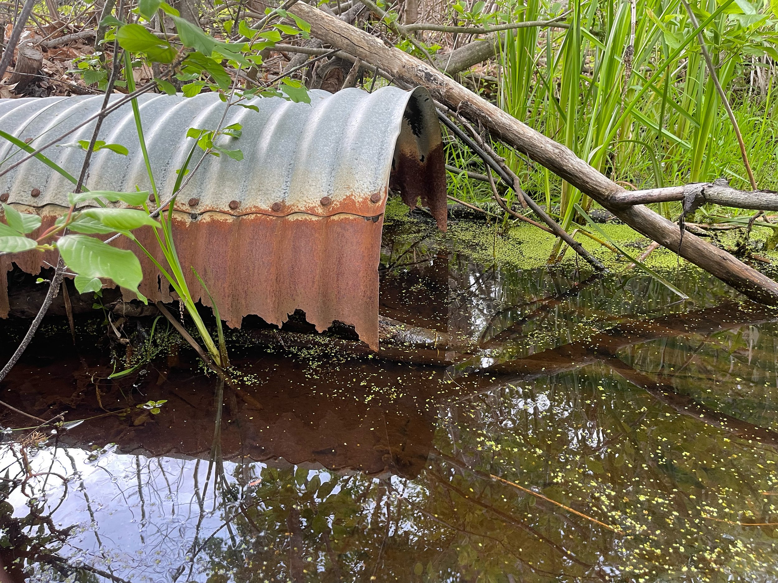
Coastal Resiliency Culvert Replacement- New Castle, NH
In 2019 118 tidal crossings were assessed across New Hampshire’s coast by the NHDES and partners. Scoring criteria were applied to prioritize each crossing focusing on the enhancement of coastal resilience for human and natural communities. Under this assessment the Pit Lane culvert received very poor scores in tidal crossing condition, infrastructure and ecological categories making it a priority for replacement.
In collaboration with the New Castle Conservation Commission (NCCC), RCCD received two funding awards to complete engineered plans and permits for the degraded Pit Lane culvert, which was noted as a priority in the NH Department of Environmental Services (NH DES) Resilient Tidal Crossings assessment (5/2019). The two funding applications approved include the NH DES, Coastal Resilient Grant (CRG), and the NH DES, Coastal Flood Risk Infrastructure Grant Program (CFRING).
The watershed was analyzed, specifically focusing on two contiguous freshwater wetlands, and a migrating saltmarsh, Lavenger Creek saltmarsh. The District has invested in restoration activities at this saltmarsh for years, and has significantly controlled the highly invasive Phragmites australis (Common reed) plant that was found in abundance. Native saltmarsh plants, including several rare species, now flourish here.
The imminent replacement of the failing culvert under Pit Lane Road is critical as it also serves as a secondary transportation option during large storm events where sections of Route 1B on the island are blocked. Once completed, this resilient culvert will also promote the safety/transportation aspects on the island, as well as allowing saltmarsh/wetland migration, adaptations which have already been documented. Due to increasing storm and tidal events, as well as increased annual precipitation, these resiliency projects will be emphasized in coming years. For more information check out the project video posted below created by Clear Eye Photo!

SLAMM (Sea Level Affecting Marshes Model)
SLAMM (Sea Level Affecting Marshes Model) is a tool that can be used to project how salt marshes may respond to sea-level rise. SLAMM predicts long term shoreline and habitat changes as a function of land elevation, tide range, sea-level rise, and other environmental factors. The SLAMM model was first run for all of NH in 2014 by NH Fish and Game Department and the Great Bay National Estuarine Research Reserve using data collected from GBNRR and SET, as well as detailed habitat information from the NERR. In 2022, the model was updated with improved with higher resolution habitat, LiDAR, and updated parameters.
The Pit Lane project site was analyzed using the NH SLAMM model. The results below compare the site’s current conditions to predicted conditions in the year 2050 with a 0.5m (1.6 ft) rise in sea level.

