
Conservation Land Management Services
RCCD offers professional stewardship monitoring, baseline documentation, and GIS mapping services to support the long-term management of conservation easements, municipal open space, and other protected properties.

Conservation Stewardship
Long-term stewardship is essential to ensuring that conservation easements and other protected properties continue to meet their conservation objectives. Regular monitoring and recordkeeping help identify changes to the property, document existing conditions, and help ensure that the terms of a conservation easement or other conservation restrictions are being upheld.
For conservation easements, the easement holder is responsible for monitoring the property and documenting its condition over time. RCCD can assist land trusts, municipalities, conservation organizations, and other property managers by providing professional stewardship services tailored to the needs of each property.
Our Stewardship Services Include
Annual or periodic monitoring of conservation easements and protected properties.
Preparation of monitoring reports documenting property conditions, and observed changes.
Inspection and documentation of boundary conditions using existing deeds, surveys, and boundary monuments.
Maintenance and replacement of existing boundary signs and markers where appropriate.*
GIS mapping and updates of property boundaries, trails, natural resources, and stewardship records.
Landowner communication and maintenance of stewardship records, including ownership updates and correspondence.
Review of aerial imagery to identify potential changes in land use, vegetation, or potential encroachments between site visits.
*RCCD does not perform land surveying or establish legal property boundaries. Boundary maintenance services are limited to documenting existing conditions and maintaining or replacing existing boundary signs and markers based on available deeds and surveys.

Existing Protected Properties
Some protected properties do not have baseline documentation, or existing records may be incomplete or outdated. RCCD can prepare baseline documentation for existing conservation easements, properties with conservation restrictions, and other protected lands to establish a reliable record of current conditions. These reports provide valuable documentation for future monitoring, stewardship, boundary management, and property planning
Baseline Documentation
Baseline documentation provides a comprehensive record of a property's condition and significant features at a specific point in time. These records serve as the foundation for future stewardship, monitoring, and management of conservation easements, properties with conservation restrictions, and other protected lands.
A well-prepared baseline report documents the natural resources, existing land uses, and property features that are important to the property's conservation values and management objectives. It also provides a detailed record of boundary conditions, helping landowners and conservation organizations track changes over time and support long-term stewardship.
Our Baseline Documentation Services Include
A review and summary of the property's conservation easement, conservation restrictions, or other relevant legal documents.
Documentation of natural resources, land use, and other features that support the property's conservation or management objectives.
Photo documentation of significant natural features, existing conditions, disturbances, and boundary features.
GIS mapping of property boundaries, photo locations, wetlands, soils, topography, tax parcels, surrounding protected lands, and other natural resources.
A comprehensive written report documenting the property's existing conditions to serve as a long-term reference.
GIS/Mapping Services
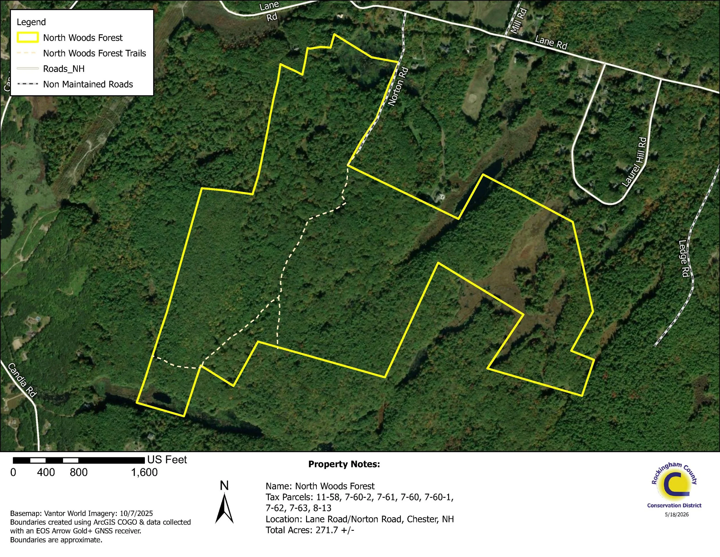
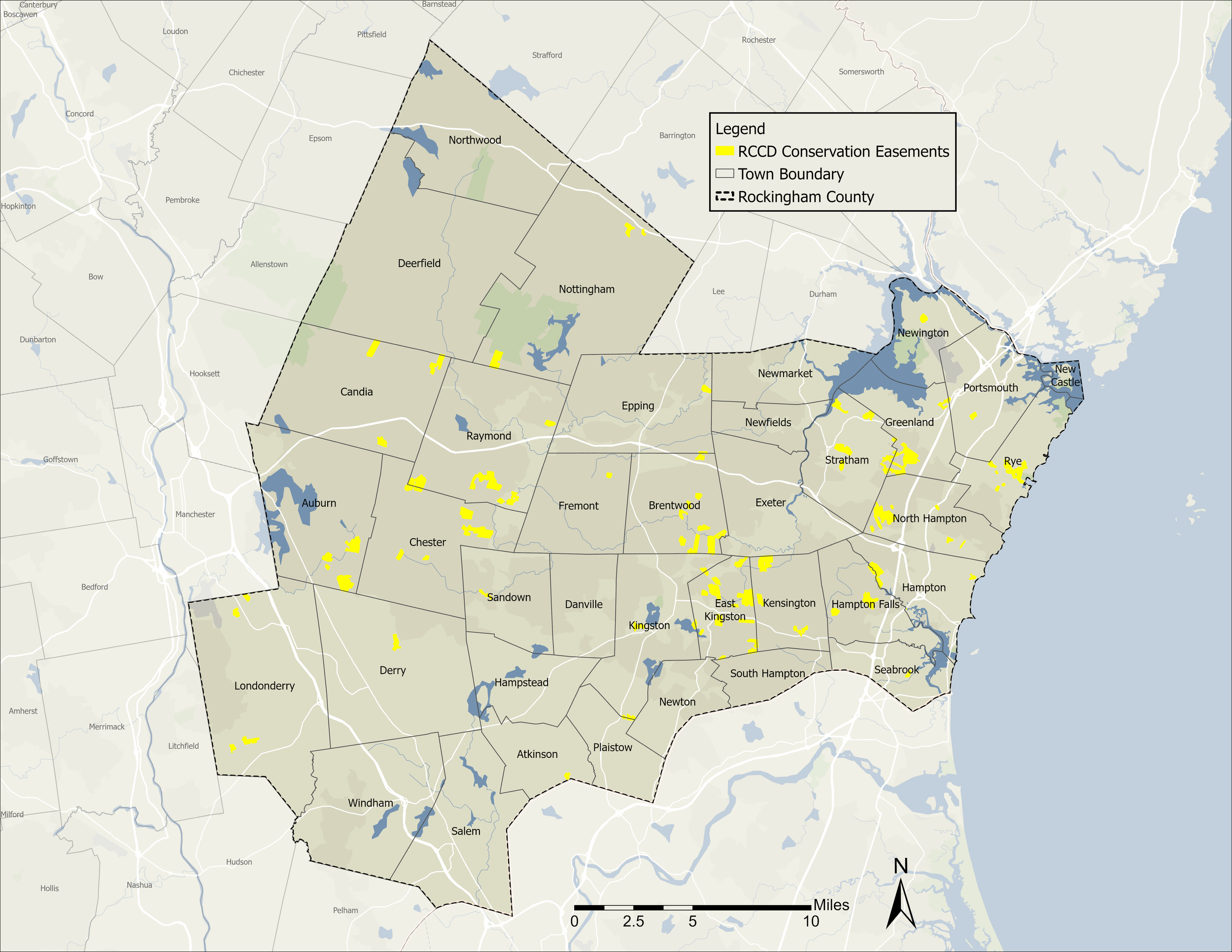
Rockingham County Conservation District provides Geographic Information System (GIS) and mapping services to support land conservation, natural resource management, and project planning. Whether you need to document existing conditions, map conservation lands, or organize spatial data, we can provide accurate, high-quality mapping products tailored to your needs.
Our GIS services include:
Mapping conservation easement and property boundaries
GPS/GNSS field data collection for high-accuracy location mapping
Mapping natural resources, including wetlands, streams, vernal pools, invasive species, and other environmental features
Creating and maintaining GIS databases for conservation properties
Developing interactive online maps for landowners, municipalities, and conservation organizations
Producing custom maps for stewardship, grant applications, management plans, and outreach materials
Integrating aerial imagery, soils, topography, parcel data, and other publicly available datasets into project maps
Using professional GIS software and high-accuracy GNSS equipment, we collect and manage spatial data that helps landowners and organizations make informed decisions about conservation, restoration, and land management.
Whether you need a single property map or a comprehensive GIS database for your conservation lands, RCCD can help develop mapping solutions that meet your project's needs.
Contact RCCD to learn more and discuss your conservation land management needs.